
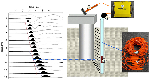
Parallel Seismic Test
The parallel seismic wave method is suitable for concealed pile foundation testing, without damaging the bearing platform and pile body. It obtains the position of the pile bottom and the integrity of the pile body through non-destructive testing technology.
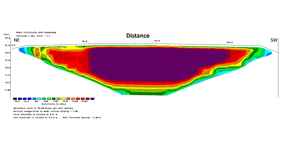
Land Resistivity Survey
Land resistivity is an important reference indicator in geological exploration and environmental protection. It can be used to detect voids, Rockhead, Metal Objects and Distribution of Silt Layer, etc.
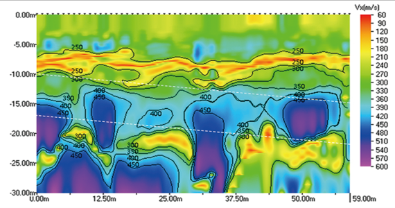
Real Time Monitoring Subsurface Space with Microtremor Survey
Microtremor Survey can be used to monitor the subsurface space in progress of the project, which can assist in construction decision-making and avoid accidents.
Land Gravity Survey
The gravity exerted on objects varies at different locations on Earth. By measuring the gravity acting on an object at a certain point, information about the crustal structure and distribution of underground resources in that area can be obtained.
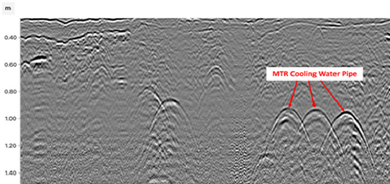
Ground Penetration Radar(GPR) Survey
Ground Penetration Radar(GPR) is an efficient, high-resolution, and easy-to-use method for shallow engineering geological exploration.
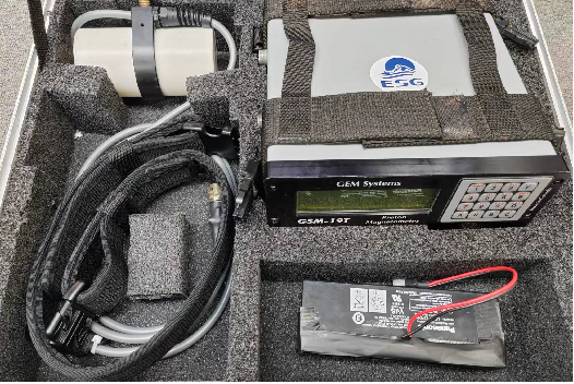
Land Magnetic Survey
Land Magnetic survey is one of the tools used by exploration geophysicists. It can be applied for detection of pipelines, underground piles, bombs, and other underground ferromagnetic objects.